- Directory
- Advanced Air Mobility White Papers
- Low Altitude Economy
- A dynamic airspace grid map based on 3D subdivision framework
A dynamic airspace grid map based on 3D subdivision framework
New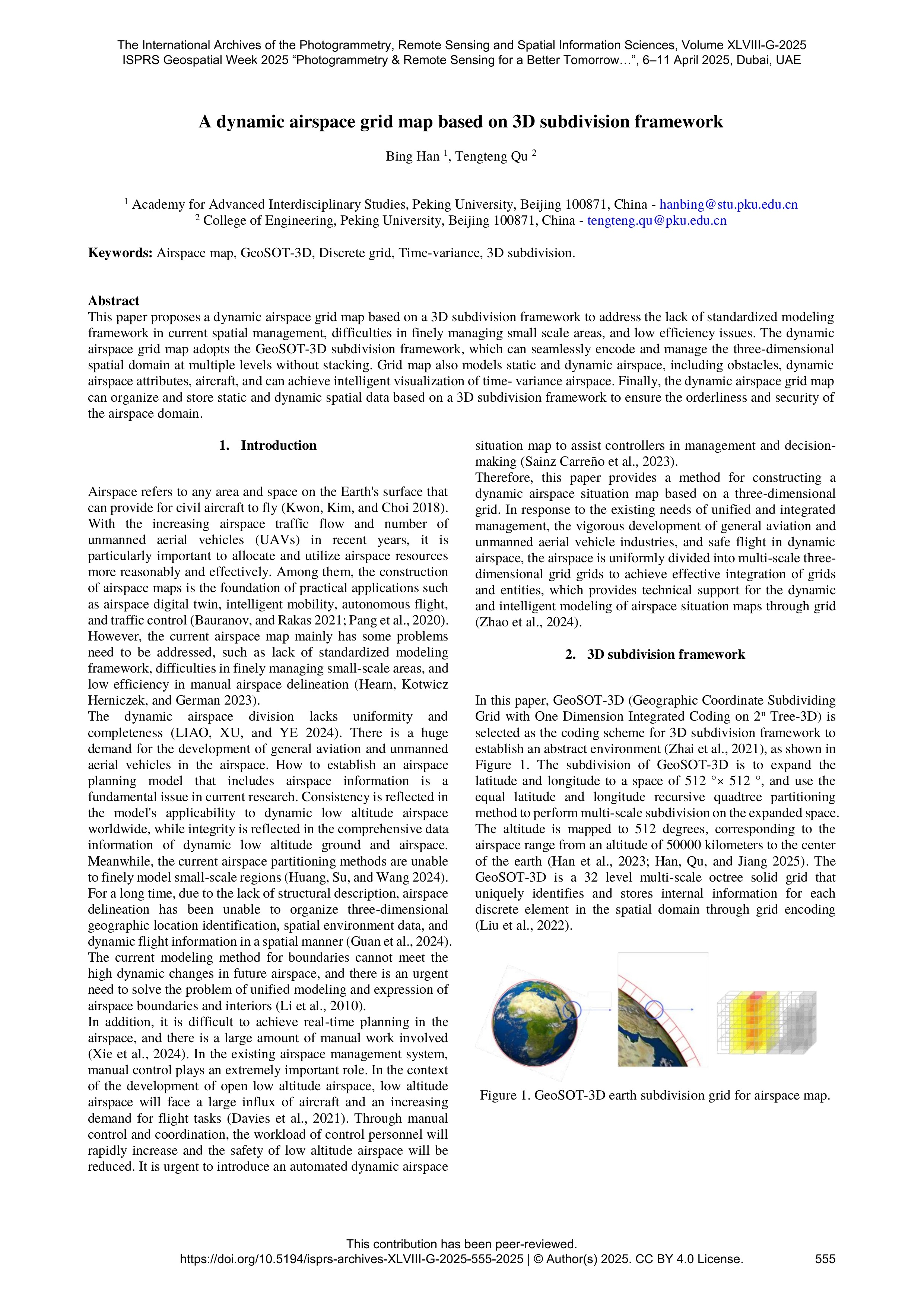
White Paper Details
This paper introduces a dynamic airspace grid map developed using the GeoSOT-3D subdivision framework. It addresses issues in current airspace management by offering a multi-scale, three-dimensional grid system for unified modeling, real-time dynamic updates, and intelligent visualization of both static and dynamic airspace elements, enhancing safety and efficiency.<!-- notionvc: 7b9652e9-2ab9-454b-82f4-912235eda3f5 -->
The paper "A dynamic airspace grid map based on 3D subdivision framework" presents a novel approach to airspace management by leveraging a 3D subdivision technology—specifically, the GeoSOT-3D framework. This framework uniquely encodes multi-level spatial data without redundancy, allowing fine-grained and hierarchical spatial representation crucial for modern airspace challenges. It tackles the lack of standardized modeling frameworks and inefficiencies in delineating dynamic and static airspace objects such as obstacles, controlled zones, and temporary restricted areas.
The authors distinguish between static and dynamic airspace components through their grid-based modeling: static obstacles like buildings and mountains are encoded and aggregated through multiple subdivision levels, whereas dynamic entities such as aircraft and temporary zones are tracked with time-variant properties. Key metrics like grid occupancy, current grid capacity, and occupancy uniformity are introduced to reflect real-time airspace utilization, supporting intelligent visualization and decision-making.
Aircraft are abstracted as particles with buffer zones to balance positional accuracy and collision safety.
Dynamic updates occur at discrete time intervals, sequentially updating grid occupancy, capacity, and uniformity, with visual indicators for warning and background states based on defined thresholds. The data structures for both static and dynamic information are carefully designed to support efficient storage, querying, and integration.
The dynamic airspace grid map can significantly improve airspace management efficiency, offering automated, scalable, and real-time insights suited for increasing UAV traffic and general aviation demands. The integration of multi-scale grids aids in flexible planning and safety assurance while providing a technical foundation for future intelligent airspace digital twins and autonomous flight control.
<!-- notionvc: b7d57422-f579-410e-b142-3ff21b1f089c -->